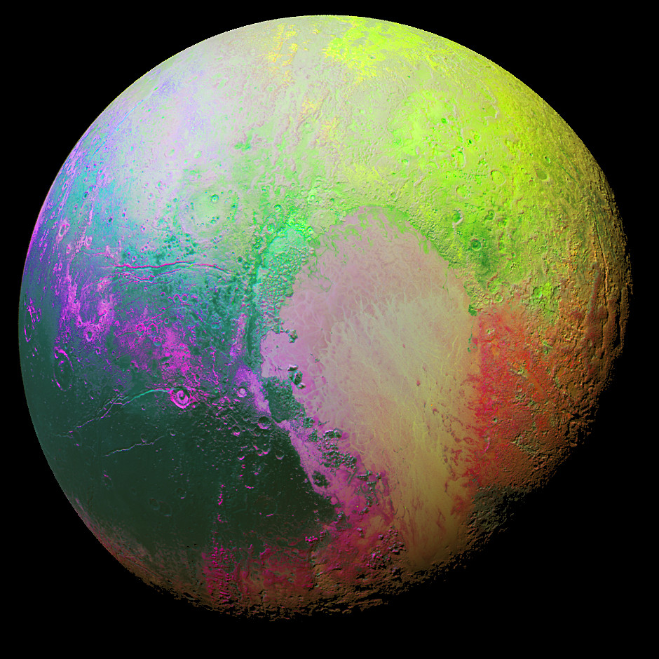
Image credit: NASA/JHUAPL/SwRI.New Horizons scientists made this false colour image of Pluto using a technique called principal component analysis to highlight the many subtle colour differences between Pluto’s distinct regions. The image data were collected by the spacecraft’s Ralph/MVIC colour camera on 14 July at 11:11 UTC, from a range of 22,000 miles (35,000 kilometres). This image was presented by Will Grundy of the New Horizons’ surface composition team on 9 November at the Division for Planetary Sciences (DPS) meeting of the American Astronomical Society (AAS) in National Harbor, Maryland.
Watch live as the countdown ticks toward the launch of an Atlas 5 rocket Thursday from pad 41 at Cape Canaveral Air Force Station with NASA’s Mars 2020 Perseverance rover. The two-hour launch window opens at 12:50 p.m. BST (1150 GMT).
After a search for an outside funding source turned up empty, NASA plans to end observations with the Spitzer Space Telescope in January to conclude a 16-year mission that discovered exoplanets, studied galaxies in the ancient universe, and peered at planets and asteroids in our own Solar System.