The full mosaic image is available by clicking here and will open in a new window.
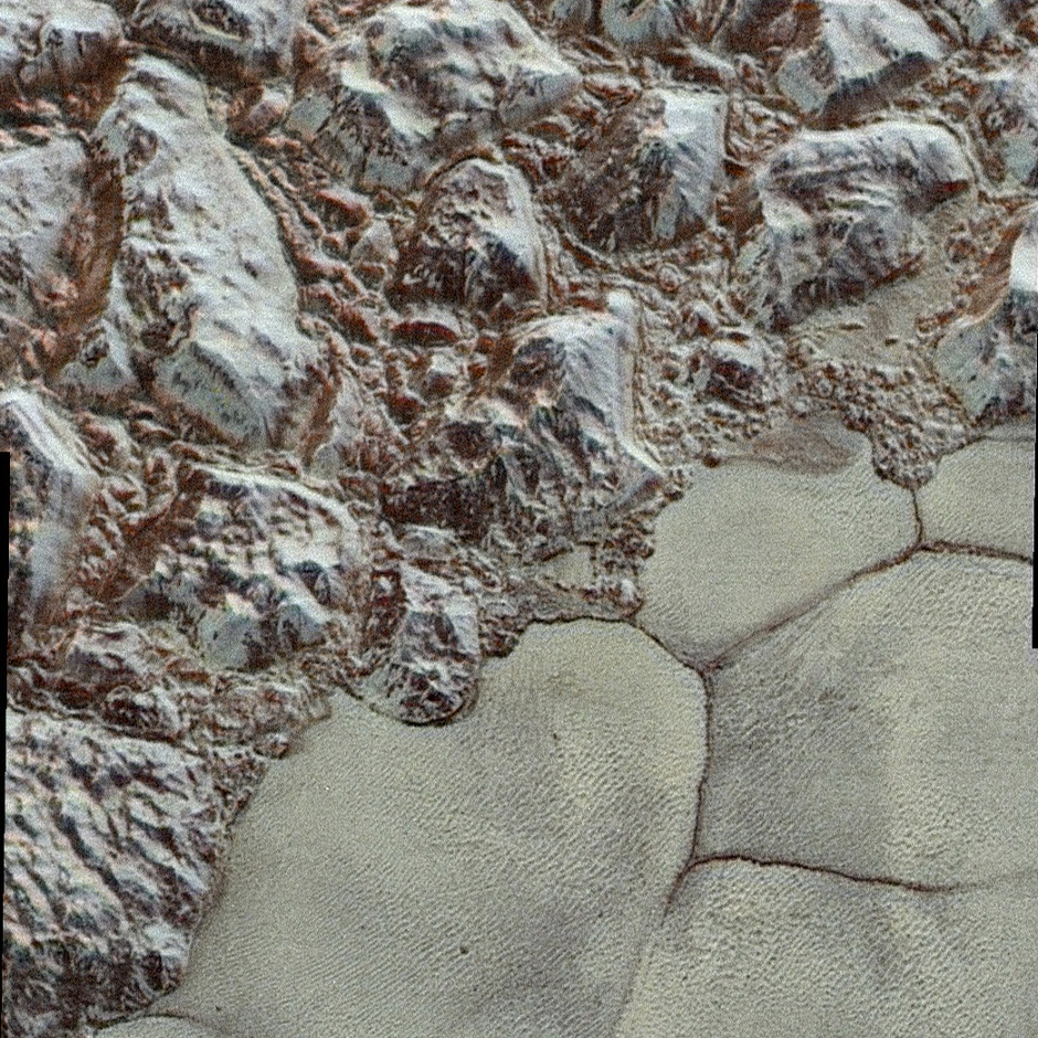
The images form a strip 50 miles (80 kilometres) wide, trending (top to bottom) from the edge of “badlands” northwest of the informally named Sputnik Planum, across the al-Idrisi mountains, onto the shoreline of Pluto’s “heart” feature, and just into its icy plains. They combine pictures from the telescopic Long Range Reconnaissance Imager (LORRI) taken approximately 15 minutes before New Horizons’ closest approach to Pluto, with — from a range of only 10,000 miles (17,000 kilometres) — with colour data (in near-infrared, red and blue) gathered by the Ralph/Multispectral Visible Imaging Camera (MVIC) 25 minutes before the LORRI pictures.
The wide variety of cratered, mountainous and glacial terrains seen here gives scientists and the public alike a breathtaking, super-high-resolution colour window into Pluto’s geology.