In this image, north is up. The southern portion of the left inset above shows the cratered plateau uplands informally named Vega Terra (note that all feature names are informal). A jagged scarp, or wall of cliffs, known as Piri Rupes borders the young, nearly crater-free plains of Piri Planitia. The cliffs break up into isolated mesas in several places.
Cutting diagonally across the mottled plans is the long extensional fault of Inanna Fossa, which stretches eastward 370 miles (600 kilometres) from here to the western edge of the great nitrogen ice plains of Sputnik Planum.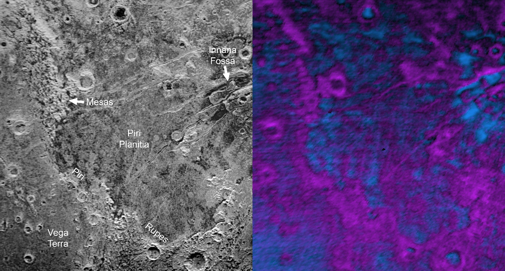
Compositional data also show that the surface of Piri Planitia is more enriched in water ice (shown in false colour as blue) than the higher plateaus, which may indicate that Piri Planitia’s surface is made of water ice bedrock, just beneath a layer of retreating methane ice. Because the surface of Pluto is so cold, the water ice is rock-like and immobile. The light/dark mottled pattern of Piri Planitia in the left inset is reflected in the composition map, with the lighter areas corresponding to areas richer in methane — these may be remnants of methane that have not yet sublimated away entirely.
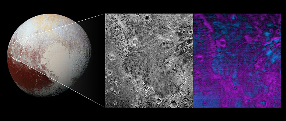
The inset at left shows about 650 feet (200 metres) per pixel; the image measures approximately 280 miles (450 kilometres) long by 255 miles (410 kilometres) wide. It was obtained by New Horizons at a range of approximately 21,100 miles (33,900 kilometres) from Pluto, about 45 minutes before the spacecraft’s closest approach to Pluto on 14 July 2015.
The LEISA data at right was gathered when the spacecraft was about 29,000 miles (47,000 kilometres) from Pluto; best resolution is 1.7 miles (2.7 kilometres) per pixel.