
The Trump administration has directed NASA to send astronauts back to the surface of the Moon by the end of 2024. The agency’s target is the Moon’s south polar region, where permanently shadowed craters provide the constant low temperatures needed to trap vast reservoirs of ice – a potential source of rocket fuel, air and water.
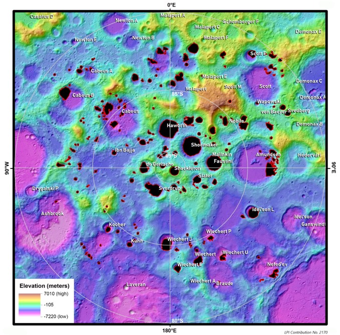
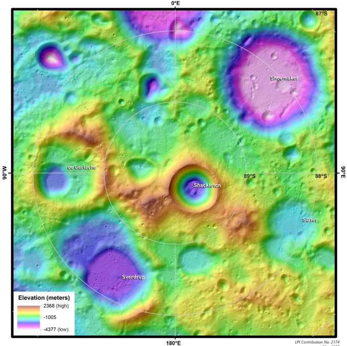
To help mission planners better understand the region, the Lunar and Planetary Institute, or LPI, is providing a new atlas of sorts covering the south polar region at varying scales complete with colour-coded elevations that clearly highlight areas where ice might be found, along with lighted areas where future crews could generate solar power to extract it.
The new atlas features 14 topographic maps based on high-resolution data from the Lunar Reconnaissance Orbiter, including digital elevation models derived from the spacecraft’s Lunar Orbiter Laser Altimeter.
“There are many exciting places to explore on the Moon, but the south pole has long held promise for a sustainable human presence,” said Julie Stopar, director of the Regional Planetary Image Facility at the LPI. “This collection can assist mission planners in this new era of south pole exploration.”
At the Moon’s poles, the Sun never climbs much higher that about a degree above the horizon. Over the course of a year, the Sun’s position along the horizon changes and while the angles and lengths of shadows reflect that changing position, the depths of some craters and other low-elevation areas never receive any sunlight. The resulting constant low temperatures can trap water ice that otherwise would sublimate away.
While it would not be easy, future astronauts may be able to use solar-powered electrolysis to break ice down into hydrogen and oxygen, allowing them, in a sense, to live off the land.
“Water-ice trapped near the lunar poles is particularly of interest for future explorers, as it may serve as a ready source of breathable air, drinkable water and spacecraft propellant,” the LPI noted when announcing the south pole atlas. “The new south pole maps can be used to identify and characterise topographically elevated (and illuminated) areas as well as permanently shadowed areas.”


