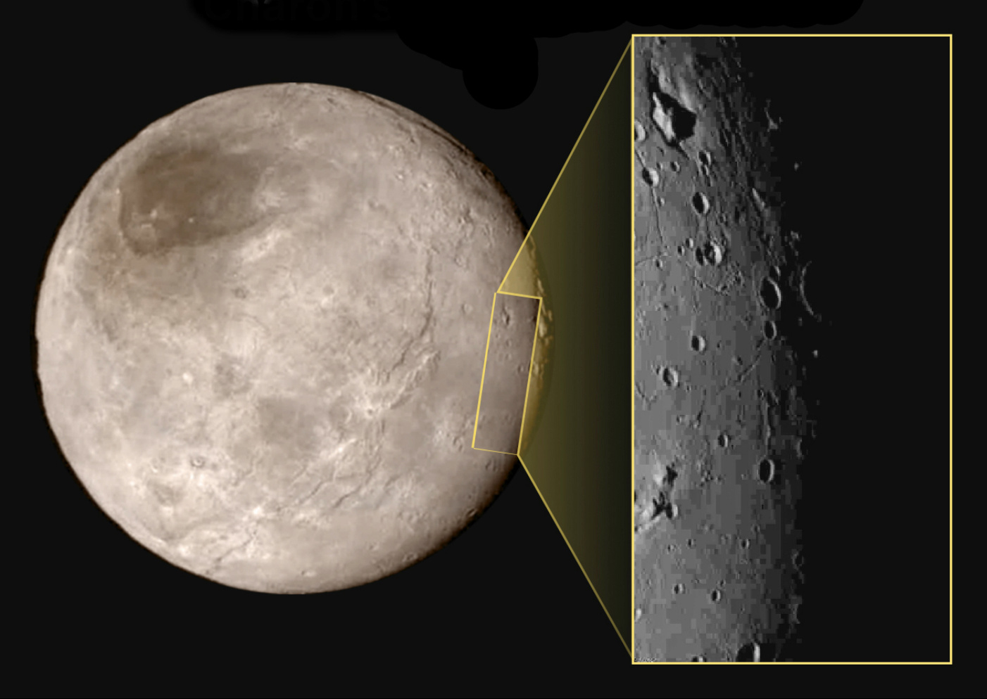
This new image of an area on Pluto’s largest moon Charon has a captivating feature — a depression with a peak in the middle, shown here in the upper left corner of the inset. The image shows an area approximately 240 miles (390 kilometres) from top to bottom, including few visible craters. The image was taken at approximately 10:30 UTC (11:30am BST) on 14 July 2015, about 1.5 hours before closest approach to Pluto, from a range of 49,000 miles (79,000 kilometres). Image credits: NASA-JHUAPL-SwRI.This image gives a preview of what the surface of this large moon will look like in future close-ups from NASA’s New Horizons spacecraft. This image is heavily compressed; sharper versions are anticipated when the full-fidelity data from New Horizons’ Long Range Reconnaissance Imager (LORRI) are returned to Earth.
The rectangle superimposed on the global view of Charon shows the approximate location of this close-up view.
The image was taken at approximately 6:30am EDT on 14 July 2015, about 1.5 hours before closest approach to Pluto, from a range of 49,000 miles (79,000 kilometres).
Mission planners preparing for the New Horizons flyby of a Kuiper Belt object on 1 January will attempt to monitor starlight as it is blocked out by the probe’s target, Ultima Thule, to update critical navigation data. Updated 4 August
The science team of NASA’s New Horizons mission has produced this global map of Pluto’s largest moon, Charon, from the data received so far from the 14 July flyby.
A subsurface ocean lies deep within Saturn’s moon Dione, according to new data from the Cassini mission. Two other moons of Saturn, Titan and Enceladus, are already known to hide global oceans beneath their icy crusts. Researchers believe that Dione’s crust floats on an ocean several tens of kilometres deep located 100 kilometres below the surface.