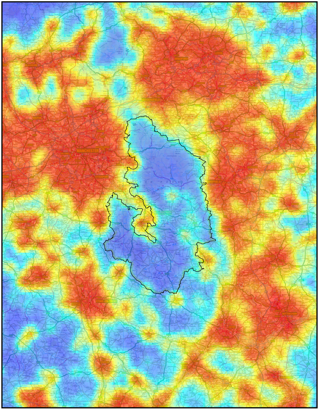
The map above shows the impact of light pollution in and around the Peak District National Park, in 2009. This map was generated using data obtained from a satellite orbiting the Earth, and has been adjusted to use artificial colour. Even though approximately 16 million people live within an hour of the National Park boundary (outlined in black), it is apparent that it is an area that is relatively unaffected by light pollution, a result of the protection of this natural landscape. Click for a full-size image. Image credit: Peak District National Park Authority.Excessive light is a pollutant in its own right, as is the energy, and carbon footprint, needed to generate it. The cultural and scientific impact is very visible, and recent studies confirm that light pollution prevents a third of the global population from seeing the Milky Way.
Dark skies are preserved in some designated areas, with parks, islands and other reserves offering places in the UK and around the world where the night sky is still relatively pristine. All these places though need continuous monitoring.
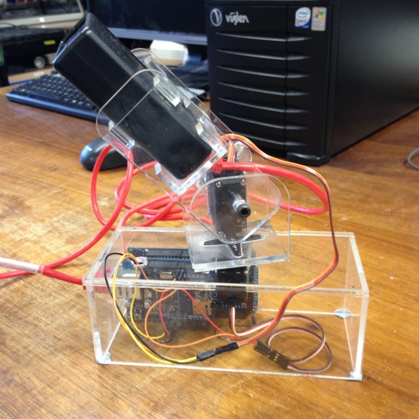
The core components of the new Sky Quality Monitoring (SQM) device. The mount was made out of laser-cut 5mm acrylic then stuck together. Image credit: Daniel Brown/Nottingham Trent University.The Nottingham Trent team will present a new mount and operational platform carrying a Sky Quality Monitoring device (SQM), which operates autonomously, and can be used to map the sky without any specialist training. Fuller worked on its development for a final year project, with Dr Daniel Brown and Dr Rob Morris, both also at Nottingham Trent.
The new monitoring system is based on a microcontroller and standard servo motors, and the data it gathers is stored on an SD card. Fuller and the team see it being used by for example national park rangers carrying out their work on site. Crucially, it is light enough to be mounted on a drone, which will take the device to inaccessible areas, making it a lot easier to create a comprehensive map.
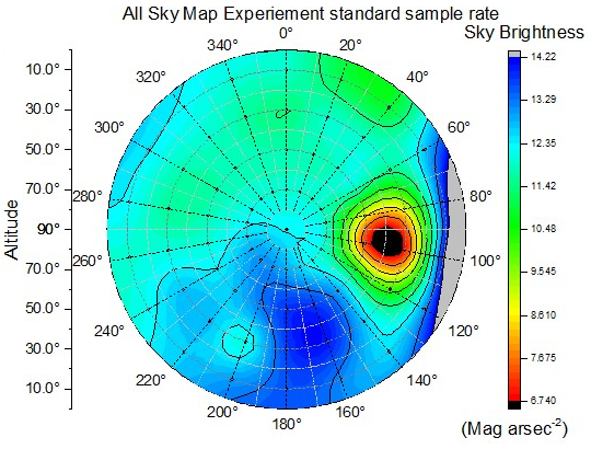
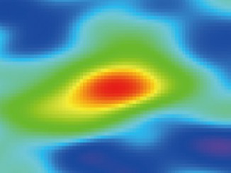
Fuller comments: “The night sky is a vital part of our heritage, and one we should strive to protect. With a drone-mounted autonomous system, we can quickly gather the evidence we need to show where the problem is worse, and on a more positive note, find out where people can see the best views of the stars.”A sky map taken using the data collected from a calibration light source. The visualisation shows the distribution of light in one hemisphere and represents what is essentially a fish-eye view of the entire sky. Image credit: Ashley Fuller/Nottingham Trent University.The team would like to see the new light pollution monitoring system, with its straightforward and low cost design, being taken up by schools and colleges. As an astronomy project, it could inspire young people to develop the skills in IT, electronics and physics that are needed for sustainability and that are so much in demand in the wider economy.
Researchers mining data from Virtual Observatory archives found 11 previously unknown compact elliptical galaxies that were isolated from from any galaxy cluster, flung out of their homes at speeds up to 6 million miles per hour to wander the void of intergalactic space.
In this Hubble Space Telescope image we see an irregular dwarf galaxy known as UGC 4459, located in the constellation of Ursa Major (The Great Bear). While UGC 4459’s diffused and disorganised stellar population of several billion sounds impressive, this is small when compared to the 200 to 300 billion stars in the Milky Way.
In general, the larger a galaxy’s mass, the higher its rate of forming new stars. However, every now and then a galaxy will display a burst of newly-formed stars that shine brighter than the rest. Researchers using the Atacama Large Millimetre Array (ALMA) have found that galaxies forming stars at extreme rates 9 billion years ago were more efficient than average galaxies today.