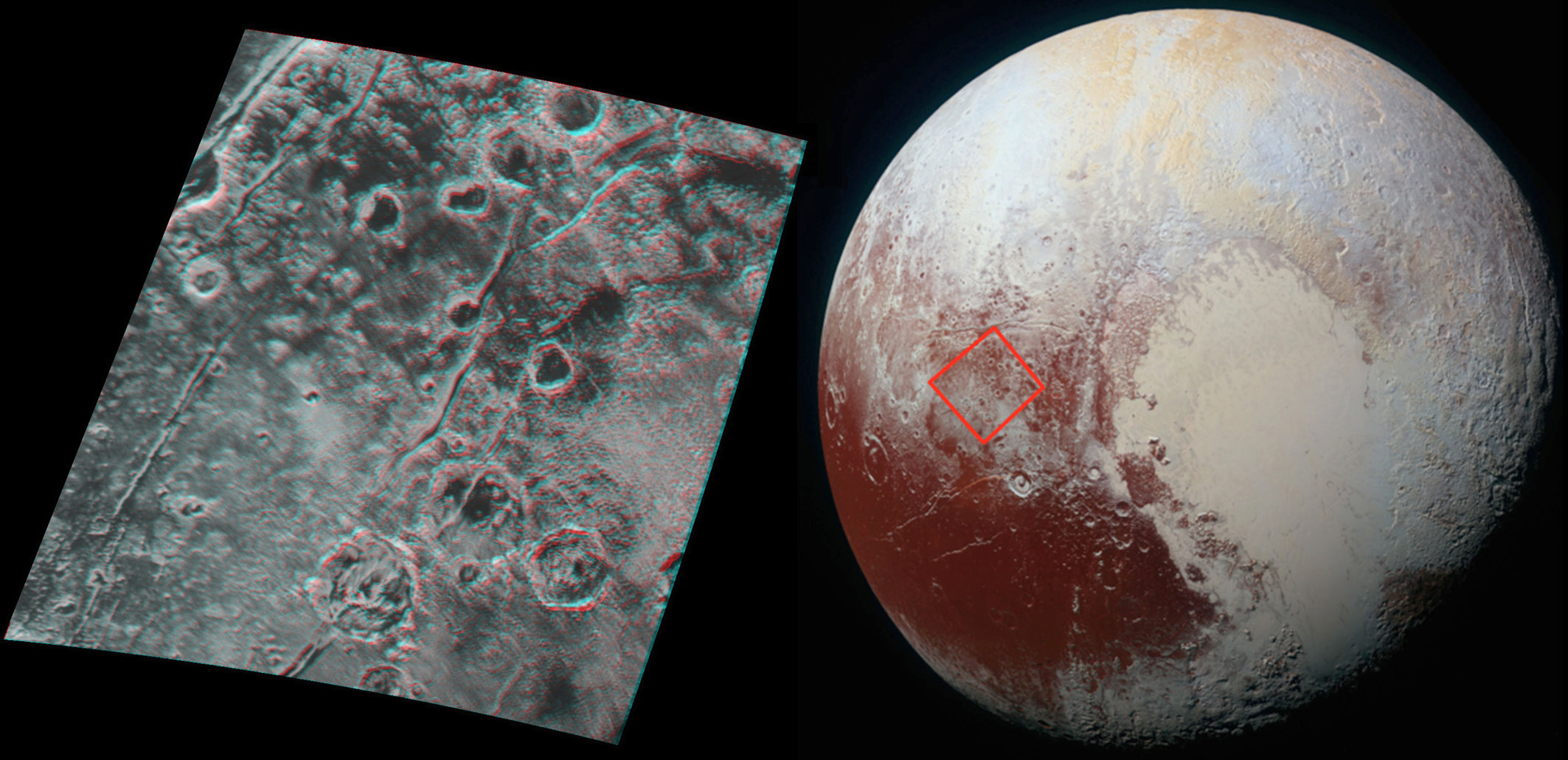
This 3-D image of Pluto, which requires red/blue stereo glasses for viewing (click the picture for a full-screen version), shows a region 180 miles (300 kilometres) across, centred near longitude 130°E, latitude 20°N (the red square in the global context image). North is to the upper left. The image shows an ancient, heavily cratered region of Pluto, dotted with low hills and cut by deep fractures indicating extension of Pluto’s crust. Image credit: NASA/JHUAPL/SwRI.Global stereo mapping of Pluto’s surface is now possible, as images taken from multiple directions are downlinked from NASA’s New Horizons spacecraft. Stereo images will eventually provide an accurate topographic map of most of the hemisphere of Pluto seen by New Horizons during the 14 July flyby, which will be key to understanding Pluto’s geological history.
This example, which requires red/blue stereo glasses for viewing, shows a region 180 miles (300 kilometres) across, centered near longitude 130°E, latitude 20°N (the red square in the global context image). North is to the upper left. The image shows an ancient, heavily cratered region of Pluto, dotted with low hills and cut by deep fractures indicating extension of Pluto’s crust.
Analysis of these stereo images shows that the steep fracture in the upper left of the image is about 1 mile (1.6 kilometres) deep, and the craters in the lower right part of the image are up to 1.3 miles (2.1 kilometres) deep. Smallest visible details are about 0.4 miles (0.6 kilometres) across.
Pluto and its Texas-sized moon Charon share an alien environment on the solar system’s outer frontier, with patches of organic ices and diverse rock types illustrated in color imagery released Tuesday.
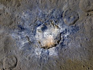
Craters with bright material on dwarf planet Ceres shine in new images from NASA’s Dawn mission taken from its lowest-altitude mapping orbit. Young crater Haulani (diameter 21 miles) and 6-mile-wide Oxo Crater — the second-brightest feature on Ceres — provide scientists with insight into the dwarf planet’s materials and surface morphology.
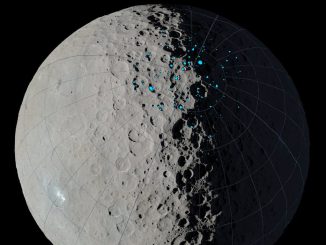
Scientists with NASA’s Dawn mission have identified permanently shadowed regions on the northern hemisphere of dwarf planet Ceres. Most of these areas likely have been cold enough to trap water ice for a billion years, suggesting that ice deposits could exist there now. These permanently shadowed regions could be colder than those on Mercury or the Moon.