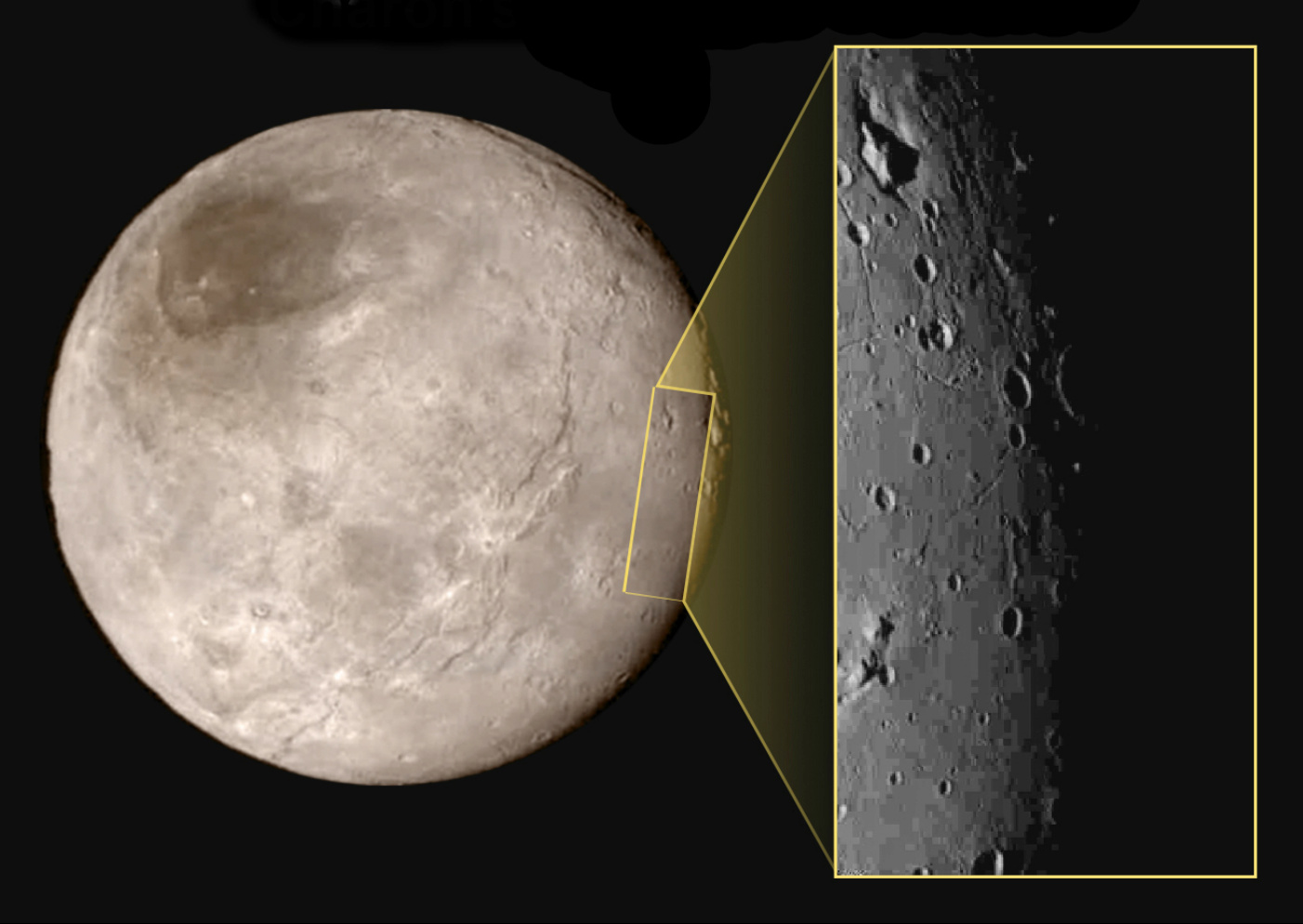
This new image of an area on Pluto’s largest moon Charon has a captivating feature — a depression with a peak in the middle, shown here in the upper left corner of the inset. The image shows an area approximately 240 miles (390 kilometres) from top to bottom, including few visible craters. The image was taken at approximately 10:30 UTC (11:30am BST) on 14 July 2015, about 1.5 hours before closest approach to Pluto, from a range of 49,000 miles (79,000 kilometres). Image credits: NASA-JHUAPL-SwRI.This image gives a preview of what the surface of this large moon will look like in future close-ups from NASA’s New Horizons spacecraft. This image is heavily compressed; sharper versions are anticipated when the full-fidelity data from New Horizons’ Long Range Reconnaissance Imager (LORRI) are returned to Earth.
The rectangle superimposed on the global view of Charon shows the approximate location of this close-up view.
The image was taken at approximately 6:30am EDT on 14 July 2015, about 1.5 hours before closest approach to Pluto, from a range of 49,000 miles (79,000 kilometres).
NASA’s New Horizons team has discovered a chain of exotic snowcapped mountains stretching across the dark expanse on Pluto informally named Cthulhu Regio. One of the dwarf planet’s most identifiable features, Cthulhu (pronounced kuh-THU-lu) is a bit larger than the state of Alaska and stretches nearly halfway around Pluto’s equator.
The science team of NASA’s New Horizons mission has produced an updated global map of dwarf planet Pluto that includes all resolved images of the surface acquired 7-14 July 2015, up to 400 metres/pixel resolution. Many additional images are expected in autumn 2015 and these will be used to complete the global map.
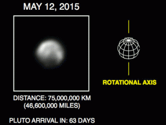
What a difference 20 million miles makes! Images of Pluto from NASA’s New Horizons are growing in scale as the spacecraft approaches its mysterious target. The new images, taken May 8th-12th using a powerful telescopic camera and downlinked last week, reveal more detail about Pluto’s complex and high contrast surface.