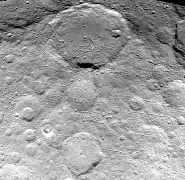
This new view of Ceres’ surface captured May 23rd and seen from a distance of 3,200 miles (5,100 kilometres) shows finer details coming into view as NASA’s Dawn spacecraft spirals down to increasingly lower orbits. Resolution in the image is about 1,600 feet (480 metres) per pixel. Image credit: NASA/JPL-Caltech/UCLA/MPS/DLR/IDA.The view shows numerous secondary craters, formed by the re-impact of debris strewn from larger impact sites. Smaller surface details like this are becoming visible with increasing clarity as Dawn spirals lower in its campaign to map Ceres.
The region shown here is located between 13° and 51° north latitude and 182° and 228° east longitude. The image has been projected onto a globe of Ceres, which accounts for the small notch of black at upper right.
OpNav9 is the ninth and final set of Dawn images of Ceres taken primarily for navigation purposes.
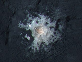
The brightest area on Ceres, located in the mysterious Occator Crater, has the highest concentration of carbonate minerals ever seen outside Earth, according to a new study from scientists on NASA’s Dawn mission. The results suggest that liquid water may have existed beneath the surface of Ceres in recent geological time.
Global stereo mapping of Pluto’s surface is now possible (requires red/blue glasses for viewing in 3-D), as images taken from multiple directions are downlinked from NASA’s New Horizons spacecraft. Stereo images will eventually provide an accurate topographic map of most of the hemisphere of Pluto seen by New Horizons, which will be key to understanding the dwarf planet’s geological history.
Astronomers have discovered possible evidence for water on the surface of 16 Psyche, the largest metallic asteroid in the solar system. Measuring 186 miles across and consisting of almost pure nickel-iron metal, Psyche is thought to be the remnant core of a planetary embryo that was mostly destroyed by impacts billions of years ago.