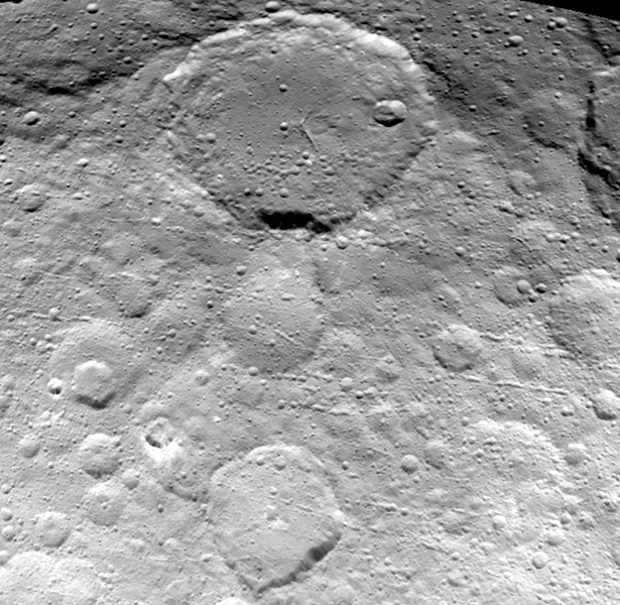
This new view of Ceres’ surface captured May 23rd and seen from a distance of 3,200 miles (5,100 kilometres) shows finer details coming into view as NASA’s Dawn spacecraft spirals down to increasingly lower orbits. Resolution in the image is about 1,600 feet (480 metres) per pixel. Image credit: NASA/JPL-Caltech/UCLA/MPS/DLR/IDA.The view shows numerous secondary craters, formed by the re-impact of debris strewn from larger impact sites. Smaller surface details like this are becoming visible with increasing clarity as Dawn spirals lower in its campaign to map Ceres.
The region shown here is located between 13° and 51° north latitude and 182° and 228° east longitude. The image has been projected onto a globe of Ceres, which accounts for the small notch of black at upper right.
OpNav9 is the ninth and final set of Dawn images of Ceres taken primarily for navigation purposes.
A new animated video of dwarf planet Ceres, based on images taken from NASA’s Dawn spacecraft’s first mapping orbit at an altitude of 8,400 miles (13,600 kilometres), as well as the most recent navigational images taken from 3,200 miles (5,100 kilometres), provides a unique perspective of this heavily cratered, mysterious world.
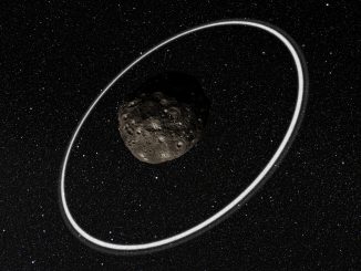
Chariklo is the largest confirmed centaur, a minor planet orbiting the Sun between Saturn and Uranus. In 2014, two rings were discovered around Chariklo. Soon after, scientists discovered that rings likely exist around another centaur, Chiron, but the origin of these rings remained a mystery — until now.
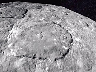
This stunning view the cratered surface of dwarf planet Ceres comes from NASA’s Dawn spacecraft. Mission scientists believe water ice deposits exist in within some of the craters where parts are in permanent shade.