|

Top Stories

|
|
| |
|

Hubble celebrates 100,000 trips around the Earth
...Hubble is today celebrating its 100,000th orbit around the Earth with the release of a spectacular image of a fantasy-like landscape embellished with scenes of stellar birth and renewal...
read more
Computer simulations put Solar System in its place
...traditional theories of Solar System formation assume our neighbourhood to be pretty run of the mill, but in a new study using data from 300 exoplanets discovered orbiting other stars, our planetary haven turns out to be one of a kind...
read more
Dark matter clumps and streams in
Milky Way
...researchers have reason to believe that dense clumps and streams of dark matter lurk in the inner regions of the Milky Way’s galactic halo...
read more
|
|
|
|
Spaceflight Now +
|
|
|
|
|
Subscribe to Spaceflight Now Plus for access to our extensive video collections!
 How do I sign up? How do I sign up?
Video archive
STS-120 day 2 highlights
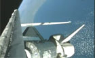
Flight Day 2 of Discovery's mission focused on heat shield inspections. This movie shows the day's highlights.
Play
STS-120 day 1 highlights
The highlights from shuttle Discovery's launch day are packaged into this movie.
Play
STS-118: Highlights
The STS-118 crew, including Barbara Morgan, narrates its mission highlights film and answers questions in this post-flight presentation.
Full presentation
Mission film
STS-120: Rollout to pad
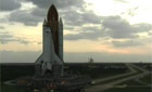
Space shuttle Discovery rolls out of the Vehicle Assembly Building and travels to launch pad 39A for its STS-120 mission.
Play
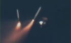
Dawn leaves Earth
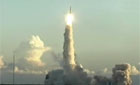
NASA's Dawn space probe launches aboard a Delta 2-Heavy rocket from Cape Canaveral to explore two worlds in the asteroid belt.
Full coverage
Dawn: Launch preview
These briefings preview the launch and science objectives of NASA's Dawn asteroid orbiter.
Launch | Science
Become a subscriber
More video
|
|
|
|
|
|
The interplanetary
map-making maverick
BY KEITH COOPER
ASTRONOMY NOW
Posted: August 22, 2008
Photographs of other worlds taken by spacecraft only tell us so much – to really get to know the surface of another planet, moon or asteroid, we have to put all the pieces together to build a map. That’s what Robert Gaskell of the Planetary Science Institute is doing with his unique mapping techniques that are producing the most accurate topographical maps ever created of other worlds. Gaskell knows the surfaces of these worlds better than anybody else, so to tie in with our Mapping the Universe feature in the just-released September issue of Astronomy Now, we found out exactly how Gaskell got involved in cartography and what his revolutionary new technique is for bringing these alien worlds to life.
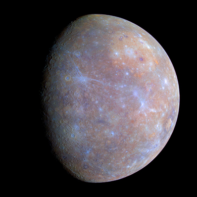
Robert Gaskell is currently working on turning the images of Mercury sent back by the MESSENGER probe into a topographical map. Image: NASA/JHUAPL/Carnegie Institution of Washington.
Surprisingly, Gaskell is a newcomer to the world of map-making, and he’s considered by more traditional cartographers as something of a maverick. “Maps of the Moon, for example, are conventionally just mindless orthographic projection,” he says. “That doesn’t make sense because far from the centre you are viewing the topography edge-on. I do an orthographic projection as a reference sphere, and at each point on that map I give the height of the true surface relative to the reference sphere of that point. I asked the folks at USGS (United States Geological Survey), but they didn’t have a name for what I was doing.”
Gaskell soon came up with his own name, stereo-photo-clinometry (SPC), and it all began during the early 1970s when Gaskell got a job at the Jet Propulsion Laboratory as an ‘optical navigator’ (OPNAV), i.e. helping navigate planetary fly-bys and their imaging targets. “My entire career has consisted of finding off-the-wall solutions to problems and OPNAV was no exception,” he says. To solve these problems, Gaskill began laying the foundations for software that, over a period of twenty-five years, would eventually evolve into SPC.
Stereo-photo-clinometry, as complicated as the name sounds, actually describes the technique in a straightforward manner. ‘Stereo-photo’ refers to imaging an object from different directions, while ‘clinometry’ describes the measurement of the slope of the land that is being imaged. In other words, “SPC means finding slopes from the way the surface looks under different illuminations, and once we know the slopes we can find the heights,” says Gaskell.
Lunar observers will be familiar with this principle. As the Moon changes phases throughout the month, and the lunar terminator creeps across the cratered surface, the illumination of that surface changes, causing shadows to lengthen or shorten. This can make craters or mountain ranges look very different, depending on when you observe them. This principle holds for worlds like Mercury, which Gaskell is currently mapping for NASA based on old Mariner 10 data and the brand new images from NASA’s Mercury MESSENGER space probe. “In principle, you would like three illumination angles since you want to solve for two directions of slope and the albedo (reflectivity) at each point,” says Gaskell. “The photometric function, however, has a weaker dependence on the viewing angle, so if you only have one illumination you are not entirely out of luck.”
The shadows can also play tricks, particularly when dealing with terrain that is alien to what we are accustomed to on Earth. “When I was doing asteroid Itokawa, [for which he won a NASA Exceptional Achievement medal] there were some features that my eye told me were crevasses, and I was very confused at the behaviour of my software. In fact, the software turned out to be right and my eyes confused by an optical illusion.”

A comparison between one of the images from the asteroid Eros taken with the NEAR probe (on the left) and Robert Gaskell's SPC model on the right. Image:NASA/JPL/PSI/Robert Gaskell.
Although Mercury is the smallest ‘proper’ planet in the Solar System with a diameter of 4,879 kilometres, it still has a surface area of 74 million square kilometres. How does one tackle such a daunting task?
“Imagine you have a bunch of small paper squares of varying sizes,” says Gaskell. “Each square has a grid of dots on it, 99 across and 99 down. You’re going to use these to cover a banana (asteroid) or a grapefruit (planet) with papier mache. First you plop on the big squares, overlapping them and molding them to the surface as best you can. Then you add progressively smaller squares, picking up finer and finer surface detail. If you want to keep track of what you've done, you first measure where the centre dot of each square is relative to the centre of the ‘fruit’, the orientation of the square, and how far you had to push each dot in the grid down (or up) to mold it to the ‘fruit’.”
Gaskell calls his imaginary paper squares ‘maplets’, and to begin he makes an educated guess about where to place his first ‘maplet’ on the surface. “We extract brightnesses from the image and project them orthographically onto the square as if it were a slide projector screen,” he explains. Depending on how well he has ‘guesstimated’ where to place the first maplet, he has to adjust the position of the square until the projections from all the different images are aligned at the centre of the computer screen.
“Since our square is initially flat, the other grid points probably won't match up,” he says. “We pick a few easily identifiable points and move them up or down, distorting our square, until they line up. This is called differential stereography.”
What about all those other points in the 99 x 99 maplet grid? “Those we could move up and down until their predicted brightness under the illumination of each image matches the actual brightness in the image, but that is a really hard thing to do, rather like juggling. Instead, we assign values to the slopes and albedos at each point and vary those until the brightnesses match.” This forms the basis of SPC, and by integrating the slopes, constrained by the stereographic points already marked on the map, Gaskell is able to ascertain the height at each grid point. He then replicates this across as many other maplets as it takes to cover the entire surface, comparing to actual photographs to ensure accuracy.
Given the power of today’s computers, perhaps it isn’t that surprising that it doesn’t take that long to create a map. “Right now I'm tiling a piece of Mercury with 156 new maplets at 300-metre resolution (the distance between the points in the 99 x 99 grid),” reveals Gaskell. “Each maplet appears in about ten images and takes about two minutes for my computer to construct, so I'll come back in about five hours and it should be done.” The more images a maplet appears in, the longer it takes for the computer to analyse and construct.
“Once we have a set of maplets, we can put them together to build a shape or a global topography model, typically with 1.57 million vectors, or higher resolution composite maps of portions of the surface. At the bottom of it all, the basic data product of SPC is the ensemble of maplets, the small paper squares in our papier mache solution.”
With spacecraft swarming around Mars, Cassini beaming back detailed images of Saturn’s moons, MESSENGER making fly-bys of Mercury and ESA’s Rosetta visiting various asteroids and comets, there are a whole slew of new worlds waiting to get the SPC treatment. “It’s like being in a big candy shop,” says Gaskell. In the meantime, Gaskell has made his maps of the near-Earth asteroid Eros available at http://idisk.mac.com/rgaskell-Public including a downloadable program called MAPMAKER.tar that Gaskell is currently testing and which can be used to access the full range of Eros data. “The source code is fortran and will need to be compiled,” says Gaskell. “It is experimental and suggestions are welcome! The documentation also describes my out-of-the-mainstream representation for global topography models. I occasionally update the database as I continue to work on Eros, so if anyone is using it they should let me know so I can inform them when the new data is available.”
For more on planetary and stellar cartography, pick up a copy of the September issue of Astronomy Now, out in your local newsagent now.
|
|
|
|
|
|